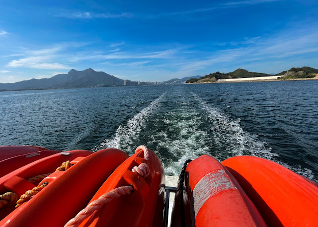
The Hong Kong Geopark covers a vast area in the eastern/northeastern part of Hong Kong and this time we only managed to stop by a few spots in the region officially known as "Northeast New Territories Sedimentary Rock Region". After a "short" 90 minute ride on a small leisure boat, we reached our first stop of Lai Chi Wo (荔枝窩), a small sea-side Hakka Village which located inside the country park. The once neglected settlement (once home to a thousand residents, we were told) is having a bit of revival in the past few years partly because of a sustainability program run by a local university - working with local villagers, deserted farmland is now regrown with produce such as rice and coffee beans, and houses were rebuilt as part of the heritage conversation effort. I certainly look forward to coming back some time to try out the coffees made using the beans harvested and roasted not far away from the village or spent a few days in the residence-turned-B&B houses that were near completion at the time of our visit.En route to Lai Chi Wo we were also able to observe some of the sedimentary rock formation along Tolo Channel, some of them considered the oldest in Hong Kong formed some 400 million years ago. I guess this was when my long-forgotten high school geography class knowledge came in handy with the geological folding and faulting process forming what we saw today. After Lai Chi Wo a quick hop on the boat brought us to Kat O (吉澳 or Crooked Island) on the northeastern tip of Hong Kong, overlooking still-busy Yantian Container Port in Shenzhen China on the other side. The history of this mixed fishing and farming village preceded that of Hong Kong, going as far back to 300 years ago and once served as a major rest stop of boats operating in the region with 10000 residents. They even got a few old cannons used to resist pirates active in the area once upon a time. While traits of past prosperity remain - one can now visit the abandoned site of the old outdoor cinema not far from the main street, the abandoned school which once had 700 students enrolled, or the elaborate Tin Hau Temple which is now a government-designated historical building - these days it's nothing more than a small town with a few shops catering mostly to weekend visitors.
We had lunch at Yik Man Restaurant (益民酒家), a small eatery on the main street specializing in indigenous Hakka Cuisine. Don't expect fine-dining treatment at this rural restaurant which got super busy during weekends but dead quiet the rest of the week, but we got a taste of no-nonsense dishes using mainly local ingredients and prepared in traditional cooking style. That included their signature minced cuttlefish balls, steamed squids with dried silverfish and the excellent Hakka Pork Stew, slow-cooked with black beans and fried tofu.
Our last stop was Ap Chau (鴨州), the smallest inhabited island in Hong Kong. It's so named ("Ap" means Duck in Cantonese) because from one side the island looks like a duck's head with its ochre-colored rock formation. Though only a few permanent residents remained in the village which once home to 300, there's a Christian church running service regularly with the whole village turned to Christianity faith a few decades ago. The "Duck's Eye" at the tip of the island certainly made one popular spot for taking an IG snapshot before we "set sail" on our return journey and a gorgeous sunset view plus a post-trip dinner awaits.We probably wouldn't have done this if we are able to travel out of town as we did before, but good to learn something new about our city and travel to somewhere so near yet so new to us.
Web: www.geopark.gov.hk
Note: In case you wonder, there are a few local tour companies offering Geopark guided tour. The one we joined was organized by Eco Institute Hong Kong (www.eco-institute.com.hk) - happy to recommend this to everyone.


No comments :
Post a Comment